

CAPTAIN SEGULL'S SPORTFISHING CHART
Offshore Buzzards Bay - Laminated Nautical Navigation & Fishing Chart by Captain Segull's Nautical Sportfishing Charts | Chart # BB14
CHF71.40
CHF119.00
 Free Shipping Sitewide
-
 Order within to get between
 -
Tracked Shipping on All Orders
-
 14-Day Returns
- Secure Payments
-
 24/7 Customer Support
Description
- Laminated Fishing Chart
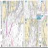
Inshore/Nearshore Fishing Chart: A nearshore chart side A, 20 to 30 miles, western portion of Martha's Vineyard west to Block Island, RI. includes Elizabeth Islands and the Sakonnet River. Side B, a detail of Buzzards Bay north to the Cape Cod Canal, includes insets of Woods Hole and Great Harbor, Robinsons Hole and Naushon Island, and Cuttyhunk Harbor and a detail of the Cape Cod Canal itself Shows fishing areas, wrecks, reefs, local names and amenities in GPS out to the thousandths of a minute. 19.5" x 26.5"
Shipping and Returns
- We offer tracked shipping on all orders. Tracking information will be shared as soon as the order is dispatched.
- Please check the delivery estimate before adding a product to the cart. This is displayed for every product on the website.
- Available shipping methods and charges will be displayed at the time of checkout, depending on your exact location.
- All customers are entitled to a return window of 14 days, starting from the date of delivery of the product(s).
- Customers are advised to read our return policy for details of the return process, eligibility, refunds as well as cancellations or exchanges.
- In case of any issues or concerns about Shipping or Returns, please contact us and we will be happy to help.
Captain Segull's Sportfishing Chart.
Offshore Buzzards Bay - Laminated Nautical Navigation & F...
CHF71.40
CHF119.00